|
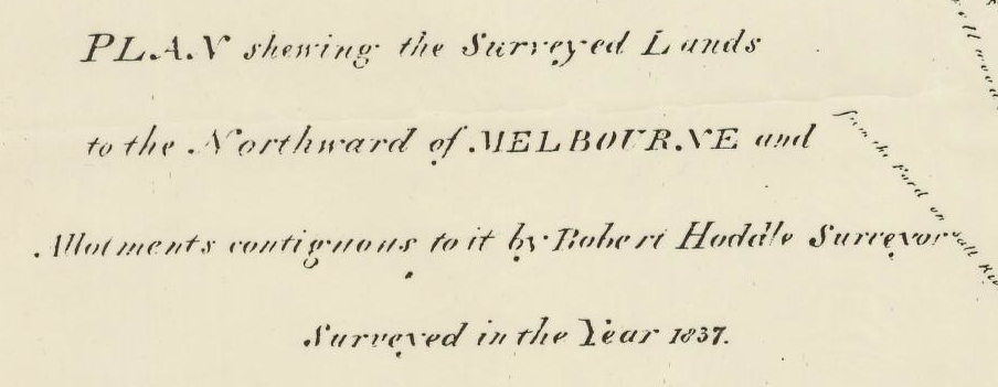
SquattersHoddle's 1837 plan marks the land around today's Koonung Cottage as 'barren forest land' and shows 'Wright's old station' in the vicinity of present day Elgar Road.
See a portion of the plan and find out more about Arundel Wrighte. |
|
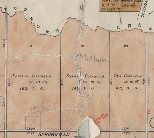
Crown land saleIn 1855 James Cousens purchased Crown land allotments 69, 70 and 71 in the parish of Nunawading. This is the area bounded by Middleborough Road, Springfield Road, Surrey Road and Koonung Creek.
Find out about the Crown land sale and see a map of the surrounding area. |
|
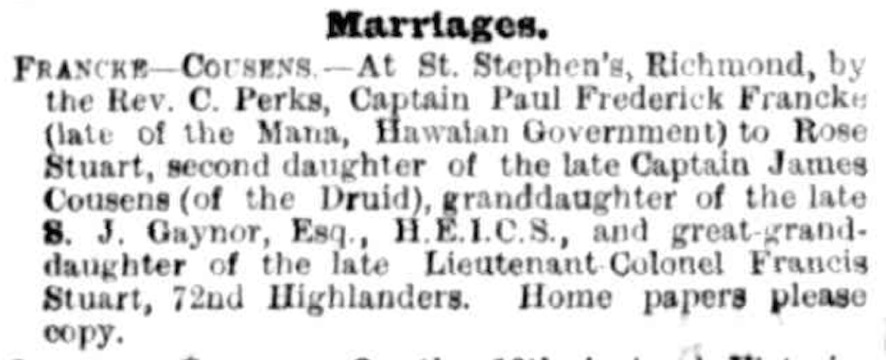
Cousens familyJames Booty Cousens was a master mariner and the family included several illustrious figures. But family estrangements and disappearances contributed to a delay of many years in distributing the Cousens' estate.
Discover more about the Cousens family. |
|
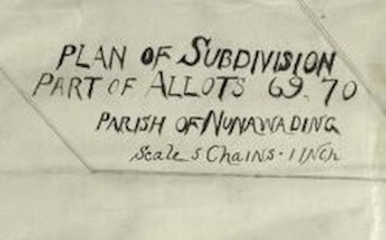
ownersCousens' Crown land sections were subdivided several times to create the current Koonung Cottage site. Various owners reveal land use and financial scandal.
See plans of subdivision and read about different owners. |
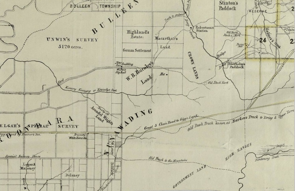
Map of part of parishes of Bulleen, Boroondara and Nunawading, c1850. (Part of map. Full map available online at State Library Victoria.)
Image sources:
- Plan shewing the surveyed lands to the northward of Melbourne and allotments contiguous to it, Robert Hoddle, 1837. Available online at State Library of Victoria (SLV).
- Nunawading Parish Plan, Public Record Office Victoria, VPRS 16171, P0001, Plans Ne-R. Reproduced with the permission of the Keeper of Public Records, Public Record Office Victoria, Australia.
- The Argus (Melbourne), 18 March 1880, p.1. http://trove.nla.gov.au/nla.news-article5978763
- Plan of subdivision, part of allots 69, 70, Parish of Nunawading (cartographic material). Available online at SLV.
- Map of part of parishes of Bulleen, Boroondara and Nunawading, c.1850. (Part of map.) Full map available online at SLV.
